Based on our detailed drone-based RTK helipad measurement report, we’re pleased to present an overview of this project which supports contractors in planning their material procurement and the repainting of the helipad.
This report leverages advanced UAV technology to provide measurements based on a stitched visual map of the roof utilizing drone imagery captured with an RTK capable UAV.
Incorporating RTK Technology for Enhanced Accuracy
Here’s a refined version of your text incorporating RTK technology:
Utilizing Real-Time Kinematic (RTK) technology in addition to GPS satellites, our UAV captures highly accurate GPS data that significantly enhances the precision of our measurements. RTK improves upon traditional GPS by providing real-time corrections to latitude and longitude coordinates during drone flight, resulting in positions with high levels of accuracy.
This RTK capability ensures that our stitched, orthomosaic, images and subsequent measurements reflect more accurate dimensions and positions of features on the helipad and surrounding areas surpassing the accuracy achievable with standard GPS alone.
The processed orthomosaic map achieved an Absolute Horizontal Accuracy (CE90) of 3.6 inches and a horizontal Root Mean Square (RMS) Error for GPS coordinates of 1.8 inches.
Area Calculations
The helipad’s coated areas were analyzed in detail and provide important data for contractors planning material procurement and executing the helipad repainting project effectively. The accuracy of our measurements supports informed decision-making and successful project outcomes.
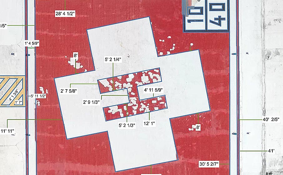
- Red Coated Areas: 924.3 square feet
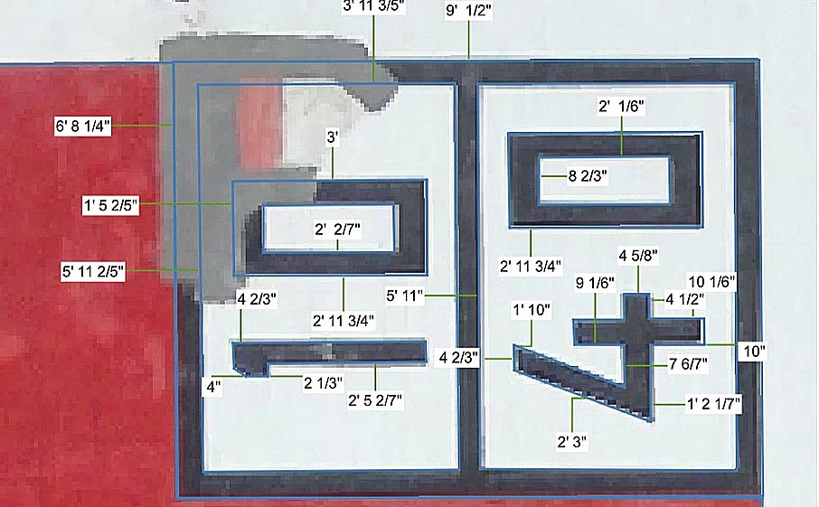
- Black Coated Areas: 24.5 square feet
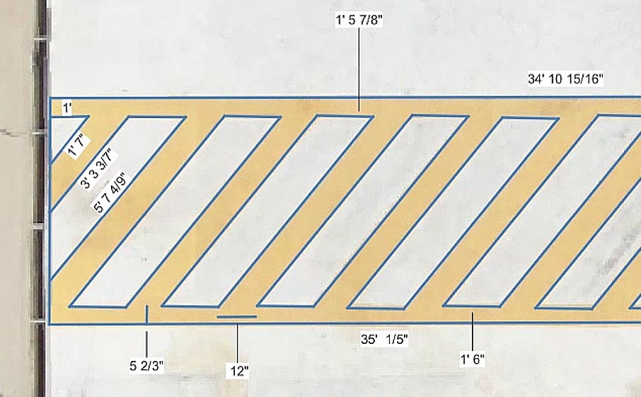
- Yellow Coated Areas: 103.8 square feet
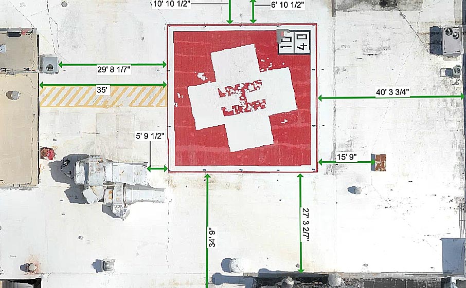
Area Measurements Illustrated
The following images display the measurements of the various areas of the helipad and its placement on the roof.
- Measurements Showing Overall Placement of Helipad
2. Measurements of Helipad’s Red Areas
3. Measurement of Black Weight & Dimension Numbers
4. Measurement of the Walkway’s Yellow Area
Ensuring Precision for Success
These measurements, derived from advanced RTK drone technology provide a solid foundation for planning and executing the helipad repainting project. With area data in hand, the contractors can proceed with material procurement and ensure the successful revitalization of the helipad.